

Topographic Survey
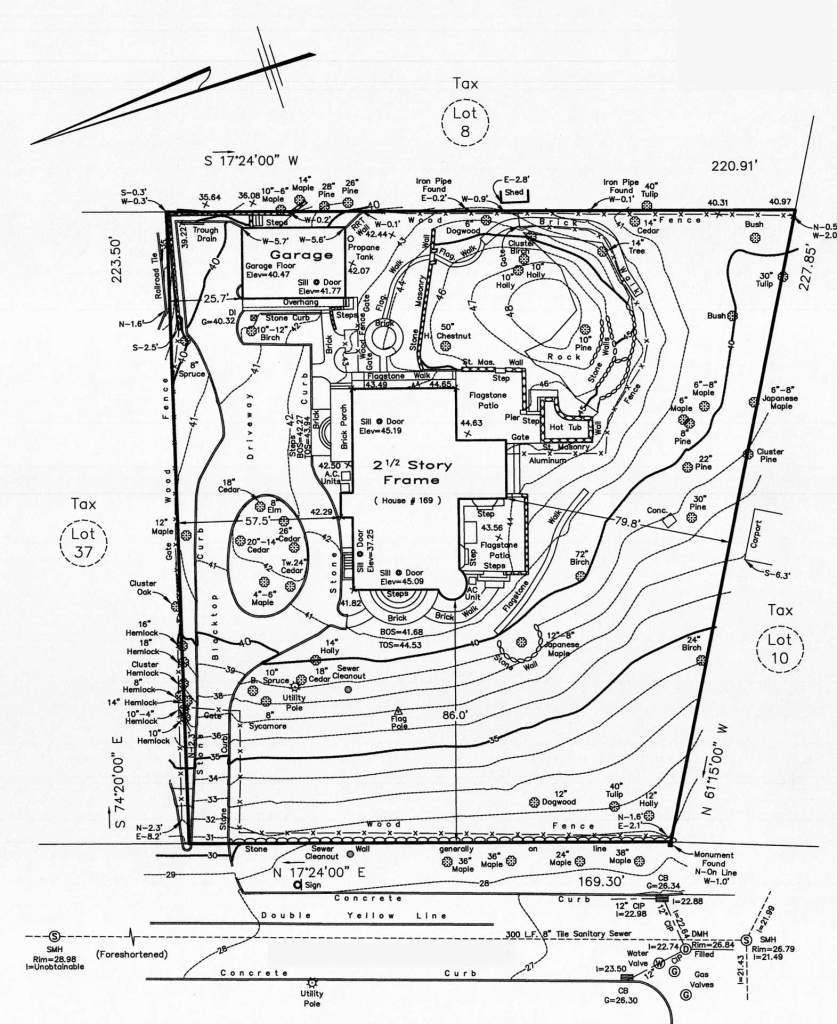
We typically recommend having prepared (if one does not already exist) an up-to-date land survey prior to or at the early stages of the landscape and site design process. This allows us to design with accurate topography, analyze zoning setbacks, specific site conditions and other limitations. Enabling increased accuracy within the design from the start.
There are different types of land surveys which provide a wide range of information. Basic Surveys are simplistic and offer the least amount of actual site conditions information. They might only show property lines and building locations. However, topographic/tree surveys (a.k.a. Existing Conditions Surveys, etc.) are more detailed and offer what we are looking for. They locate natural and man-made features like fences, paving, trees, contours, elevations and bodies of water for example.